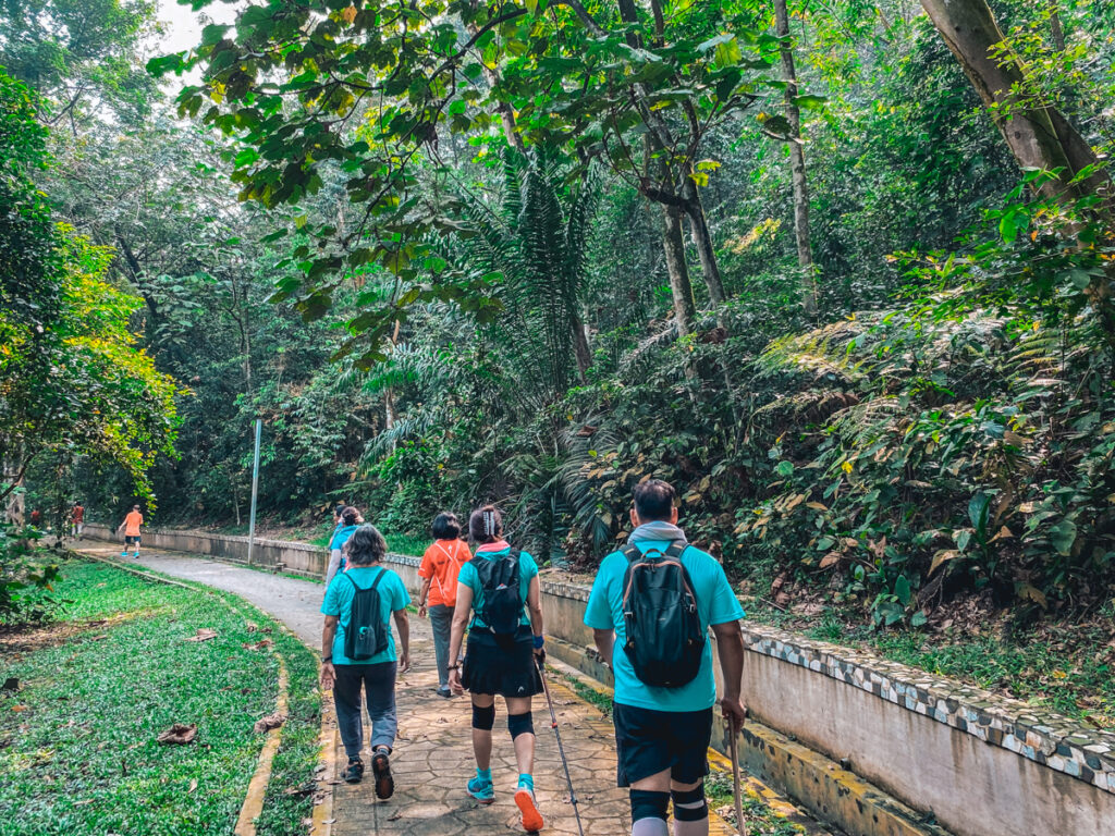
Bukit Kiara Park, one of the last remaining green spaces in Kuala Lumpur, is a popular park that attracts hiking enthusiasts and nature walkers daily. Known for its accessible location and well-maintained trails, it is one of my favorite hiking spots in KL to escape the hustle and bustle and experience tranquility. You will occasionally find mountain bikers happily blazing these trails but not to worry, there’s enough space for everyone to take a breather in this green lung! However, Bukit Kiara Hill is a lot larger than you think. It contains 400 acres of forested area for public use so you can get lost finding your way around! Here is everything you need to know!
This is a guest post by Anna from The Amateur Climber. She is an upbeat travel writer and a rock-climbing enthusiast who enjoys all things adrenaline!
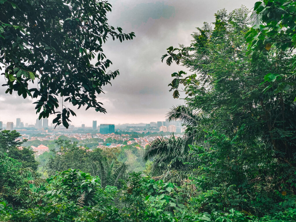
View from Bukit Kiara Hill in Kuala Lumpur, Malaysia
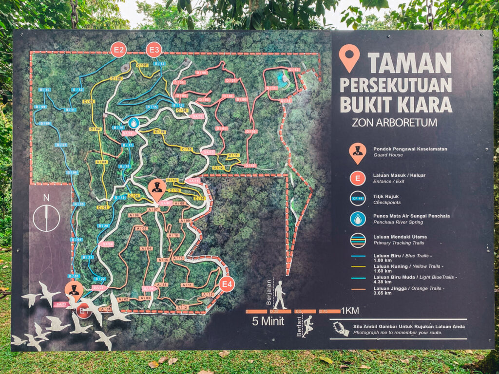
There are multiple trail map signs located at various parts of the jungle.
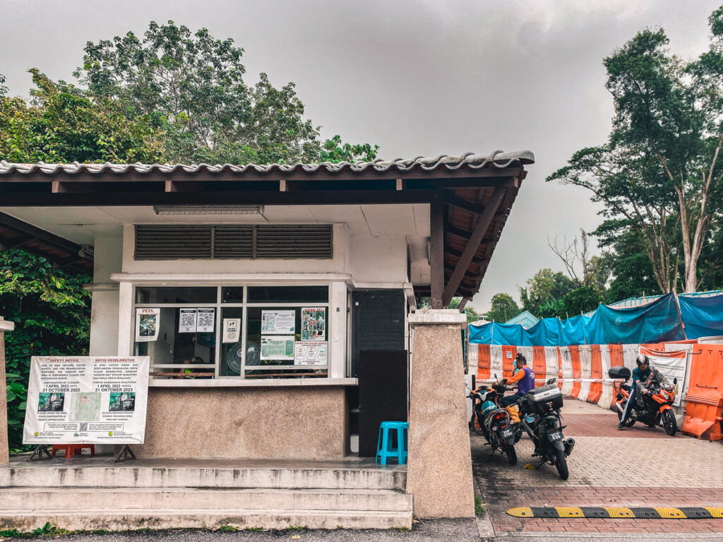
There are a few trailheads into the hill. For beginners, I will recommend starting from TTDI Park or Kiara Hill Guard House.
If you are coming from Kuala Lumpur, you can hail a taxi or e-hailing cab to get to Bukit Kiara’s entrance. It is a 15-minute drive from the city center.
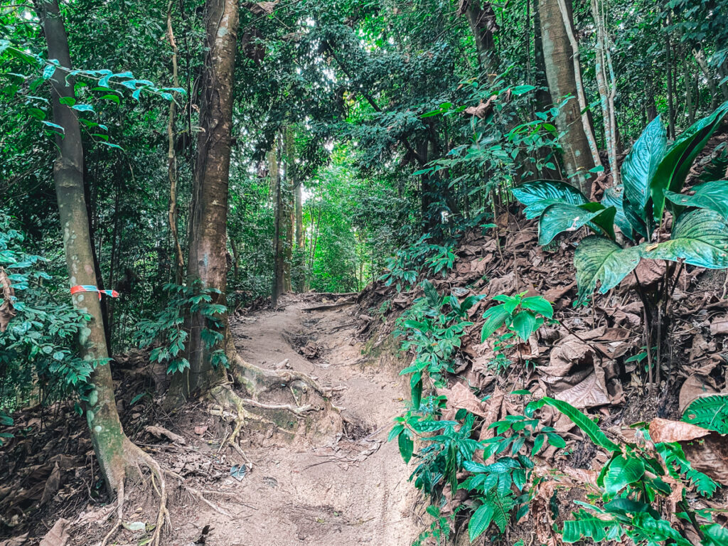
Entrance to Bukit Kiara is free with plenty of street parking available. While there are a dozen trails to choose from, here are some of my favorites where I’ve broken down the Bukit Kiara hiking distance and difficulty.
If you haven’t been jungle trekking in KL for a long time but want to get your steps in, then this route will fit you perfectly.
You will start from the parking lot at TTDI Park and head into the forest, moving towards the left. You will then make your way down to the park where you will start noticing tiles.
From there, you will make a circle around the park and end your hike here! You will also spot many monkeys and monitor lizards making their rounds.
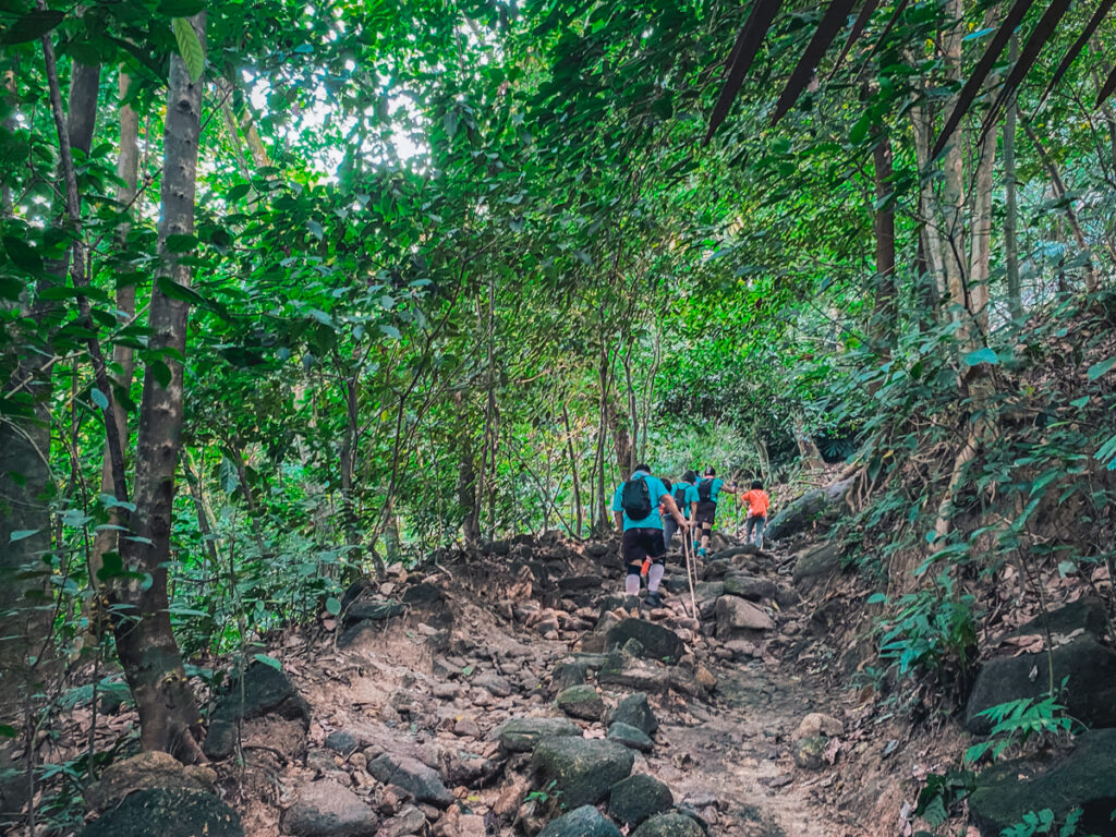
Getting to the peak is going to be slightly challenging but not without the little perks you get to visit on the way up.
From the same TTDI parking lot, walk through the Lower Carnival trail where your first highlight of the day will be Angkor Wat Tree.
These stacking rocks and outgrown tree roots bear a similar resemblance to the original Angkor Wat. However, this spot has been closed for rehabilitation work multiple times in a year due to soil erosion. If you are there, please avoid stepping on these roots!
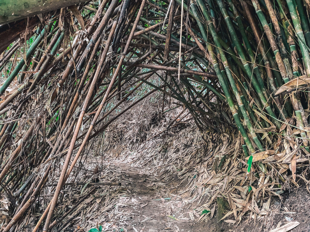
Next, you will see the bamboo canopy where the iconic Cat Eye is located. It may look like a regular bamboo arch but with the right angle, it will become the picturesque “cat eye” captured in many photos.
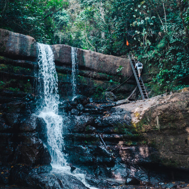
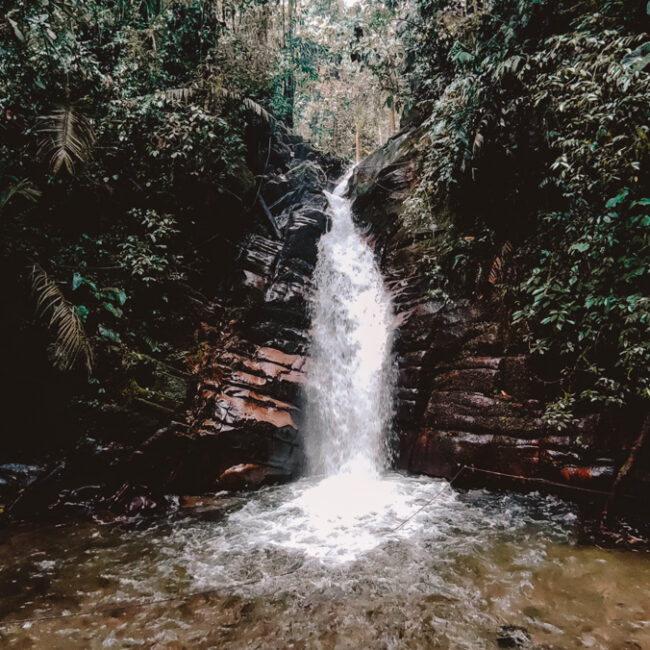
You will then reach the Bukit Kiara peak! After that, make your way down a steep route to the mini waterfall to dip your feet.
This trail is a fun route for beginners with some muddy tracks. Suitable for trail running enthusiasts, it starts from the entrance near the Kiaramas Ayuria condominium and continues on a straight pathway to Bechler’s Trail.
This route branches out to multiple lookout points, first to the KL view followed by the Mutiara Damansara viewpoint. You can also make pitstops at other popular attractions such as the waterfall and the bamboo canopy.
There are many alternative routes along the way but I suggest sticking to this trail as you may get lost finding your way back to the right path.
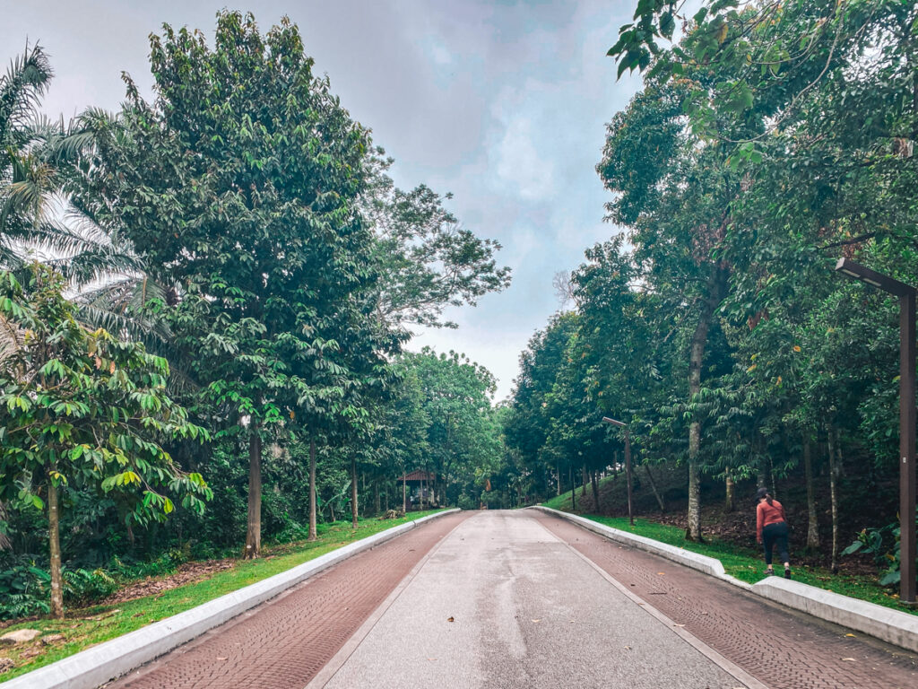
This trail is one of my favorite hiking routes as you will be walking on a wide concrete pavement throughout most parts of the course. Honestly, it feels like I’m walking in a park than a nature trail! The route begins at Kiara Hill guardhouse with a gradual incline to the top.
As you walk along the pavement, there are multiple off-road trailheads for you to continue your journey. For example, the Pakis trail brings you to a lush greenery of ferns and a natural water stream whereas the Keladi trail takes you to Kiara waterfalls.
This is a moderately challenging route that is still family-friendly with several loops. You will be crossing a small river and if you are lucky, you will spot giant fungi mutations such the cauliflower mushrooms sprouting out of tree trunks.
It is quite easy to get lost in this windy route so make sure you have your map in hand! Also, watch out for mountain bikers here as they love practicing on the bends in this route.
Most of these trails are accessible on the AllTrails or Komoot app, thanks to the contribution of regular hikers in the area.
Want to hike a longer track? Try reaching twin peaks via hiking from Bukit Sri Bintang to Bukit Kiara. This arduous route is catered for the brave and it is best to travel in groups.
Just to get a glimpse of what I had to deal with, there were plenty of mosquitos, stray dogs, and rubbish along the way.
Nevertheless, you will definitely check off most of the popular Bukit Kiara attractions. If you time it well, you can get a glimpse of the sunrise or sunset at either end of the trail.
This route starts from Jalan Palimbayan 3 where you will face a steep incline of tarmac road before reaching the jungle.
Once you reach the Bukit Sri Bintang peak, make your way down the hill to the North-South Expressway where you will cross underneath the bridge.
Once you have passed the drain, take the first left where you will find a stream. Continue and pay attention to the markings on the trees to guide you to the right path.
When you make your way back to Sri Bintang Hill, you can use a shortcut by walking up the stream where you will discover a concrete tunnel that leads back to Sri Bintang.
Bukit Kiara is open all year round, rain or shine.
If you need help with directions, go during their peak hours on weekend mornings from 7 a.m. onwards and you will meet plenty of friendly hikers who will guide you.
Do take note that some trails may be closed temporarily for maintenance and rehabilitation work. But not to worry, there are still plenty of alternative routes for you to explore!
Yes, it is possible to go on a self-guided walk in Bukit Kiara. Some hikers have used the All Trails app as a map to get around different trails.
However, if this is your first time hiking at Kiara Hills, I highly recommend you join other experienced hiking groups! Most of them can be found on Facebook such as Kiara Hills TTDI Hiking Group.
Yes, it is safe if you follow a hiking group. Although there is a low chance you will get lost in Bukit Kiara, it is better to be safe than sorry, especially in these unknown terrains.
Recently, there have been more sightings of illegal settlers, particularly near the Yoshino trail. As such, I advise solo hikers and female travelers to highly avoid this area.
The Cat Eye is a point of interest located at the Bamboo Canopy. You will find plenty of bamboo sticks forming a “cat-eye” arch, with you representing the “pupil” as you walk through. Once you pass the Angkor Wat tree, you will spot the Cat Eye nearby.
Hiking routes at Bukit Kiara can range from 2.61 miles to 10 miles. Multiple trails intersect one another so your distance can differ if you take certain detours or start at a different entrance. You can take anywhere from 2 to 5 hours to complete the hiking trails.
The highest point in Bukit Kiara is 270 meters (886 feet). If you are walking on the Twin Peaks trail, you will be rewarded with a panoramic view of the KL skyline from the highest point of the hill. Get a breath of fresh air when you are there!
All in all, this Bukit Kiara hike is worth the experience! If you lived here long enough, you will understand why this hiking place in KL has become a popular spot for the local community.
And if you are backpacking in Malaysia and need a breather from the KL heat, it’s worth visit Bukit Kiara too!
Remember to stay hydrated and follow the useful tips I’ve provided to get you started on your adventure!
ENJOY!
Disclaimer: This post may include affiliate links. If you click on them, I may receive a commission at no extra cost to you.

Hi! I am Annelies and this is Travelers & Dreamers, a blog about conscious travel which means traveling in a more mindful way, with a positive impact on the world and yourself!
On this website, I cover different topics like slow travel, plant-based food guides, responsible travel, sustainable packing, eco-travel, and more!
Latest Posts

15 Best Things to Do in Nong Khiaw, Laos (2024)
Santa Rita, Salento: All You Need to Know
Do you want to receive my latest finds on conscious and sustainable travel directly to your inbox? Subscribe here!
© COPYRIGHT TRAVELERS&DREAMERS, 2023.